Skip to content
Toggle Navigation
Home
Research
Ranking
Systems
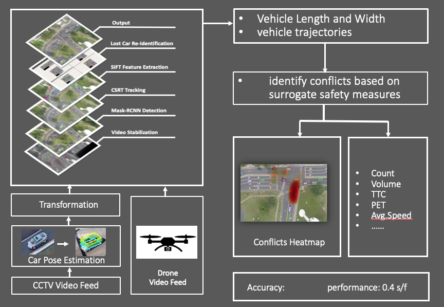
Automated Roadway Conflicts Identification System
Near Miss Event Detection System
Driving Visual Environment Detection
Team
Webinars
In the News
TRB 2025
arcis
By
pa180882
|
2023-10-11T20:35:53+00:00
October 11th, 2023
|
Page load link
Go to Top